Buscemi et al. 2020, fig. 4
Francesca Buscemi, Pietro Maria Militello, Cettina Santagati, Marianna Figuera, Graziana D'Agostino, Damiano Antonino Angelo Aiello
Related article: Buscemi F., Militello P. M., Santagati C., Figuera M., D'Agostino G., Aiello D. A. A. 2020, Use and reuse of spatial and quantitative data in archaeology: from 3D survey to serious game at Phaistos (Crete), «Archeologia e Calcolatori», 31.1, 189-212 (https://doi.org/10.19282/ac.31.1.2020.09)
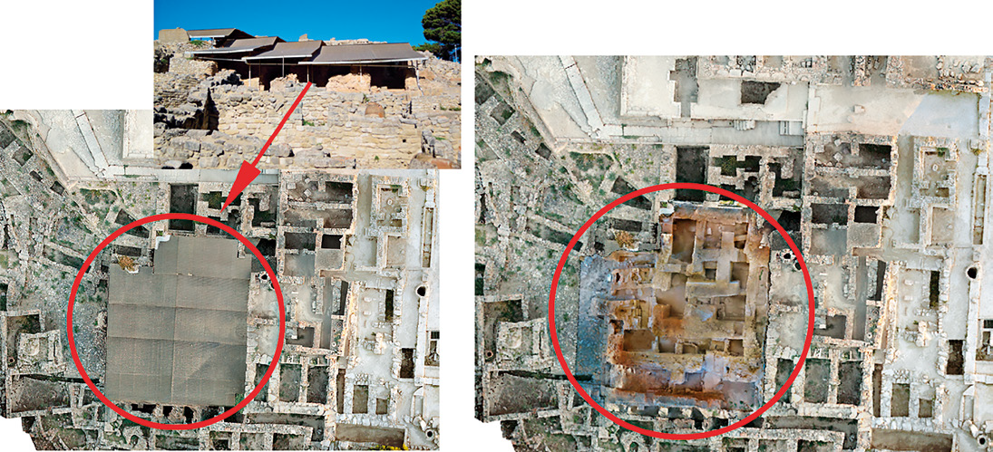
Caption
Integration of the sheltered areas in aerial photogrammetry (courtesy of the Phaistos Project) with the South-Western Quarter, through the geotiff extracted by the 3D model (GIS elab. M. Figuera).
Image preview
This website uses only technical cookies strictly necessary for its proper functioning. It doesn't perform any profiling and doesn't use third party cookies of any kind.
Read our privacy policy for additional information.
By clicking 'OK' or closing this banner you acknowledge having read this information and accept the website's contents.