Abballe 2023, fig. 8
Related article: Abballe M. 2023, Legacy imagery, continuous satellite monitoring and targeted drone surveys for the study of deserted medieval fortified settlements in the hinterland of Ravenna, Italy, «Archeologia e Calcolatori», 34.2, 225-246 (https://doi.org/10.19282/ac.34.2.2023.12)
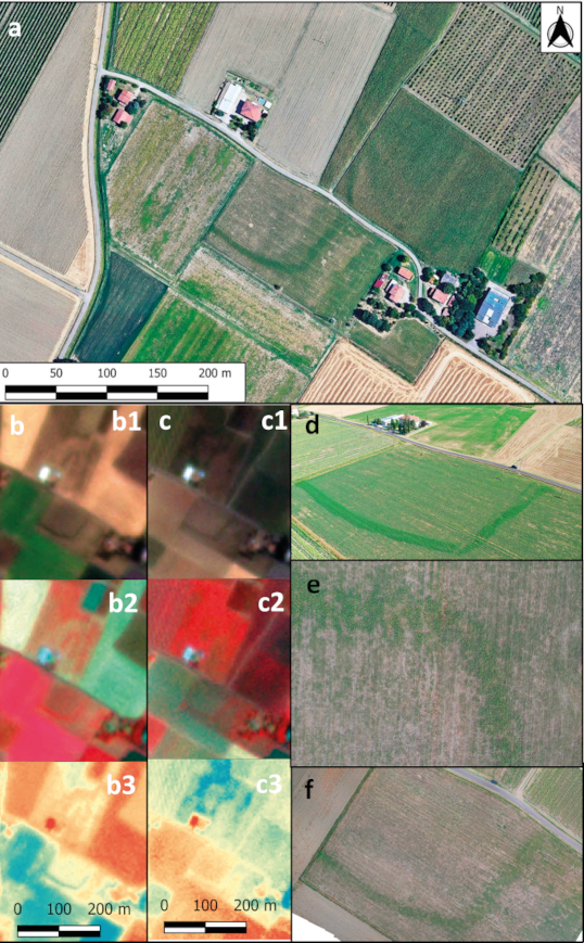
Caption
Site of castrum Taularie with section of moat visible: a) satellite image captured on 16th June 2017 provided by Google Earth Pro; b-c) PlanetScope images of 11th July 2020 and 12th July 2021 in RGB (b1-c1), False Colour (b2-c2) and NDVI (b3-c3) visualisations; d) drone image of 14th July 2020; e-f) drone vertical image and orthophoto of 18th July 2021
Source
Google Earth; Planet Labs PBC
Image preview
This website uses only technical cookies strictly necessary for its proper functioning. It doesn't perform any profiling and doesn't use third party cookies of any kind.
Read our privacy policy for additional information.
By clicking 'OK' or closing this banner you acknowledge having read this information and accept the website's contents.