Rosati 2023, fig. 1
Related article: Rosati P. 2023, “ArchaeoloGIS” a QGIS plugin for archaeological spatial analysis, in J. Bogdani, S. Costa (eds.), ArcheoFOSS 2022. Proceedings of the 16th International Conference on Open Software, Hardware, Processes, Data and Formats in Archaeological Research (Rome, 22-23 September 2022), «Archeologia e Calcolatori», 34.1, 193-200 (https://doi.org/10.19282/ac.34.1.2023.21)
Caption
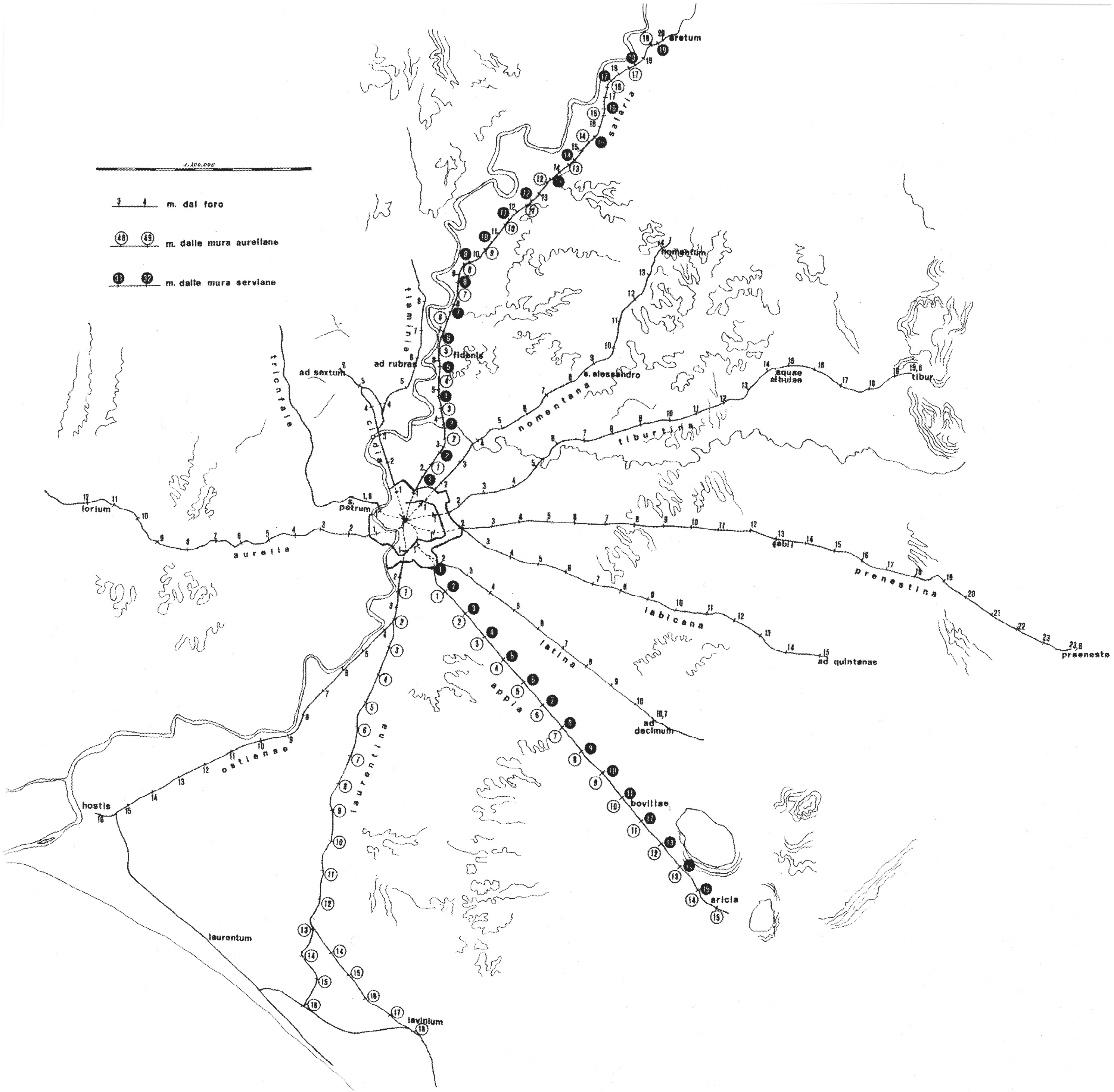
The ancient road network around Rome as reported by the Tabula Peutingeriana (from Passigli 1999, fig. 1)
Source
Passigli S. 1999, Osservazioni sul calcolo delle miglia da Roma sulla Tabula Peutingeriana, in Z. Mari, M.T. Petrara, M. Sperandio (eds.), Il Lazio tra antichità e medioevo, Studi in memoria di Jean Coste, Roma, Quasar. pp. 505-511, fig. 1
Image preview
This website uses only technical cookies strictly necessary for its proper functioning. It doesn't perform any profiling and doesn't use third party cookies of any kind.
Read our privacy policy for additional information.
By clicking 'OK' or closing this banner you acknowledge having read this information and accept the website's contents.