Buscemi et al. 2020, fig. 5
Related article: Buscemi F., Militello P. M., Santagati C., Figuera M., D'Agostino G., Aiello D. A. A. 2020, Use and reuse of spatial and quantitative data in archaeology: from 3D survey to serious game at Phaistos (Crete), «Archeologia e Calcolatori», 31.1, 189-212 (https://doi.org/10.19282/ac.31.1.2020.09)
Caption
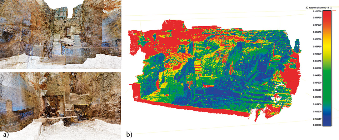
South-Western Quarter, a) views of the GoPro point cloud; b) results in terms of deviation between the laser scanning and GoPro point clouds visualized in Blue/Red scalar field.
Image preview
This website uses only technical cookies strictly necessary for its proper functioning. It doesn't perform any profiling and doesn't use third party cookies of any kind.
Read our privacy policy for additional information.
By clicking 'OK' or closing this banner you acknowledge having read this information and accept the website's contents.