Vanni et al. 2025, fig. 7
Related article: Vanni E., Cirigliano G. P., Cammisola A., Zocco S. 2025, Revealing the (un-)known in marginal landscapes. Multi-scalar LiDAR applications in the mountainous area of Monti Aurunci (Latium), «Archeologia e Calcolatori», 36.1, 109-128 (https://doi.org/10.19282/ac.36.1.2025.06)
Caption
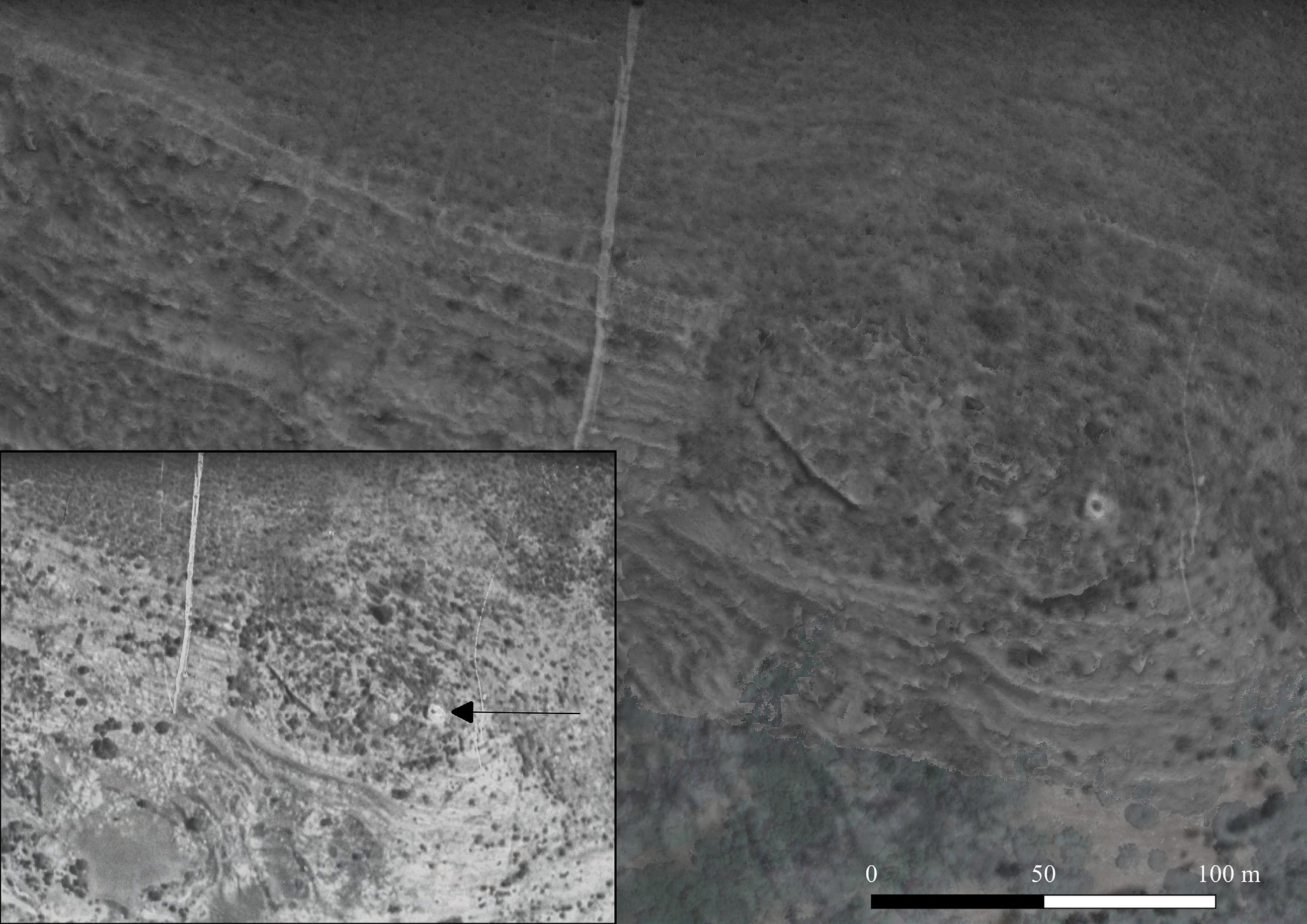
Our LiDAR image processed with the Royal Air Force image taken in 1942 in transparency (in the left box below), showing the tower still standing (elaboration E. Vanni after IGM archive aerial photos from RAF flights year 1942, swipe 13)
Source
IGM archive aerial photos from RAF flights year 1942, swipe 13
Image preview
This website uses only technical cookies strictly necessary for its proper functioning. It doesn't perform any profiling and doesn't use third party cookies of any kind.
Read our privacy policy for additional information.
By clicking 'OK' or closing this banner you acknowledge having read this information and accept the website's contents.