Citter C., Paciotti Y. 2023, Shaping a juridical district: a postdictive approach, «Archeologia e Calcolatori», 34.1, 321-328 (https://doi.org/10.19282/ac.34.1.2023.34)
Copy to clipboard Download: BibTeXShaping a juridical district: a postdictive approach
«Archeologia e Calcolatori» 2023, 34.1, 321-328; doi: 10.19282/ac.34.1.2023.34
Abstract
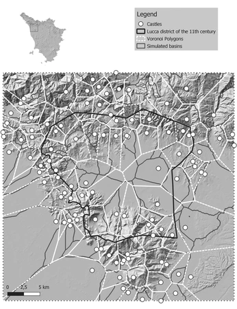
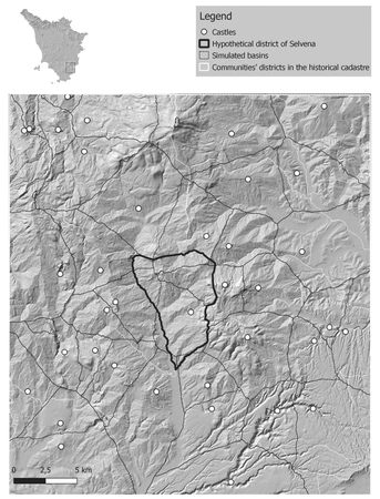
How can we study the making of a medieval juridical space? Which were the agents that affected more? We try to answer to these questions thanks to a postdictive approach. We applied the QGIS algorithms to model the potential political space. We used several agents to get different outcomes. We tried both environmental and human agents to avoid the more deterministic side of this approach. We focused on the plain of Lucca in Northern Tuscany to study the making and development of its bishopric. Then we turned to the southern side of this region to study the district of a castle already excavated and whose territory is known quite well: Selvena. In this last example, we applied a regressive procedure, starting from the 19th century communities boundaries and making hypotheses about the relationship with medieval districts. This procedure can be applied to any context where a certain amount of data is available.
Figures
Preview
Subjects:
GIS and cartography Survey and excavations
Download (PDF)Publishers:
CNR - Istituto di Scienze del Patrimonio Culturale
Edizioni All'Insegna del Giglio
This website uses only technical cookies strictly necessary for its proper functioning. It doesn't perform any profiling and doesn't use third party cookies of any kind.
Read our privacy policy for additional information.
By clicking 'OK' or closing this banner you acknowledge having read this information and accept the website's contents.


