Applicazione del rilevamento geomatico alla Domus della regina d’Inghilterra a Pompei (VII, 14, 5): risultati preliminari
Alice Capobianco, Sara Gagliolo
«Archeologia e Calcolatori»
2022, 33.1,
17-34;
doi: 10.19282/ac.33.1.2022.02
Abstract
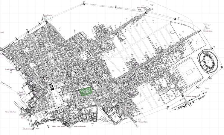
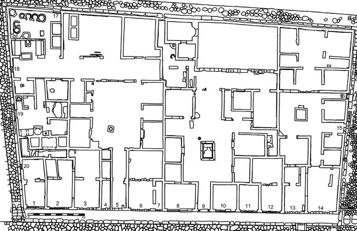
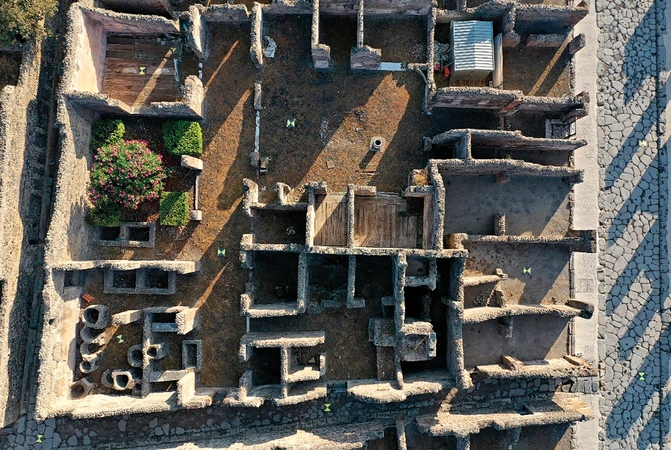
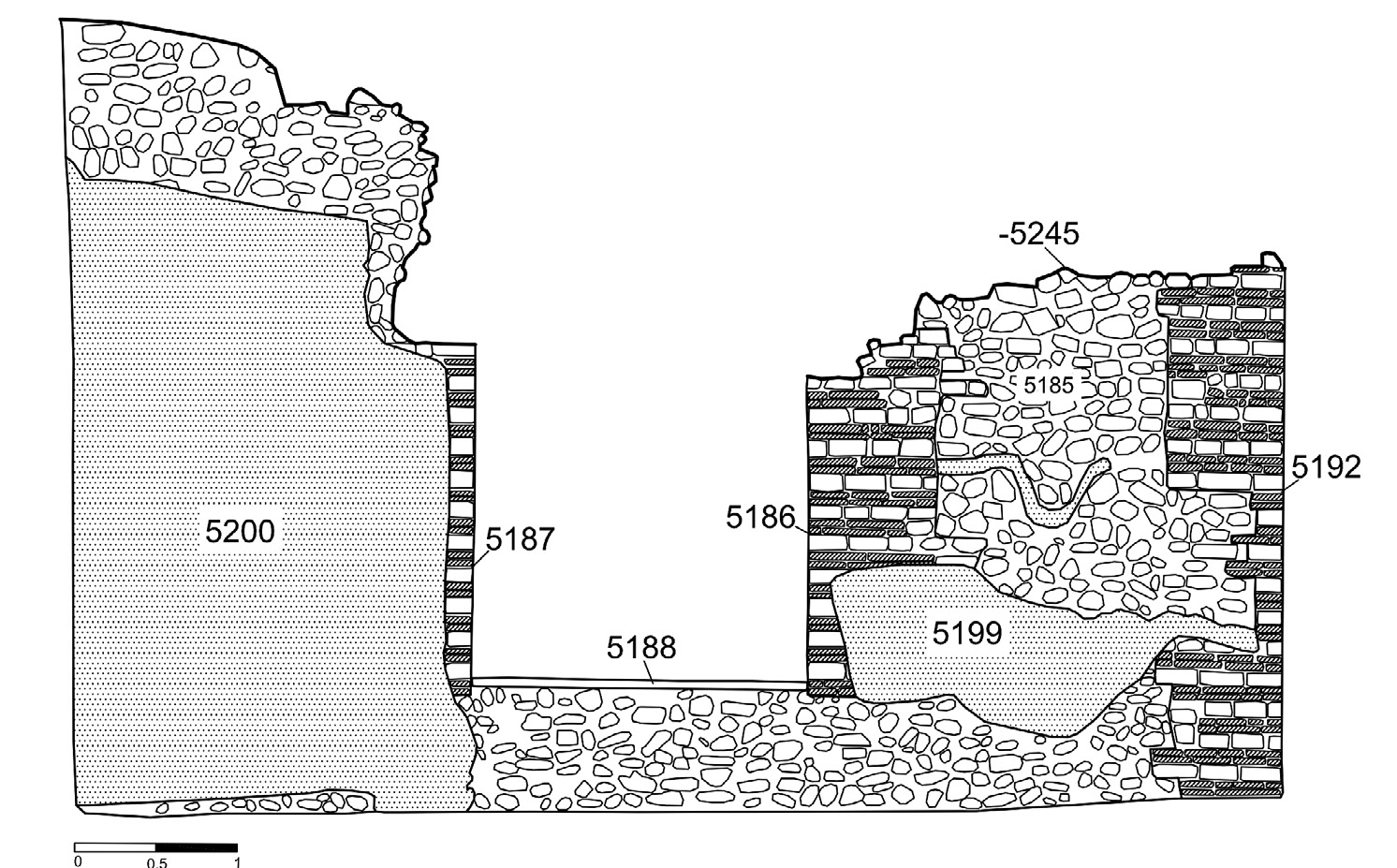
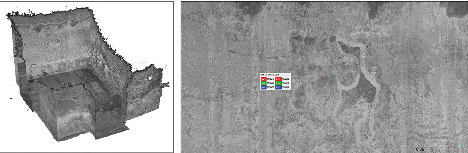
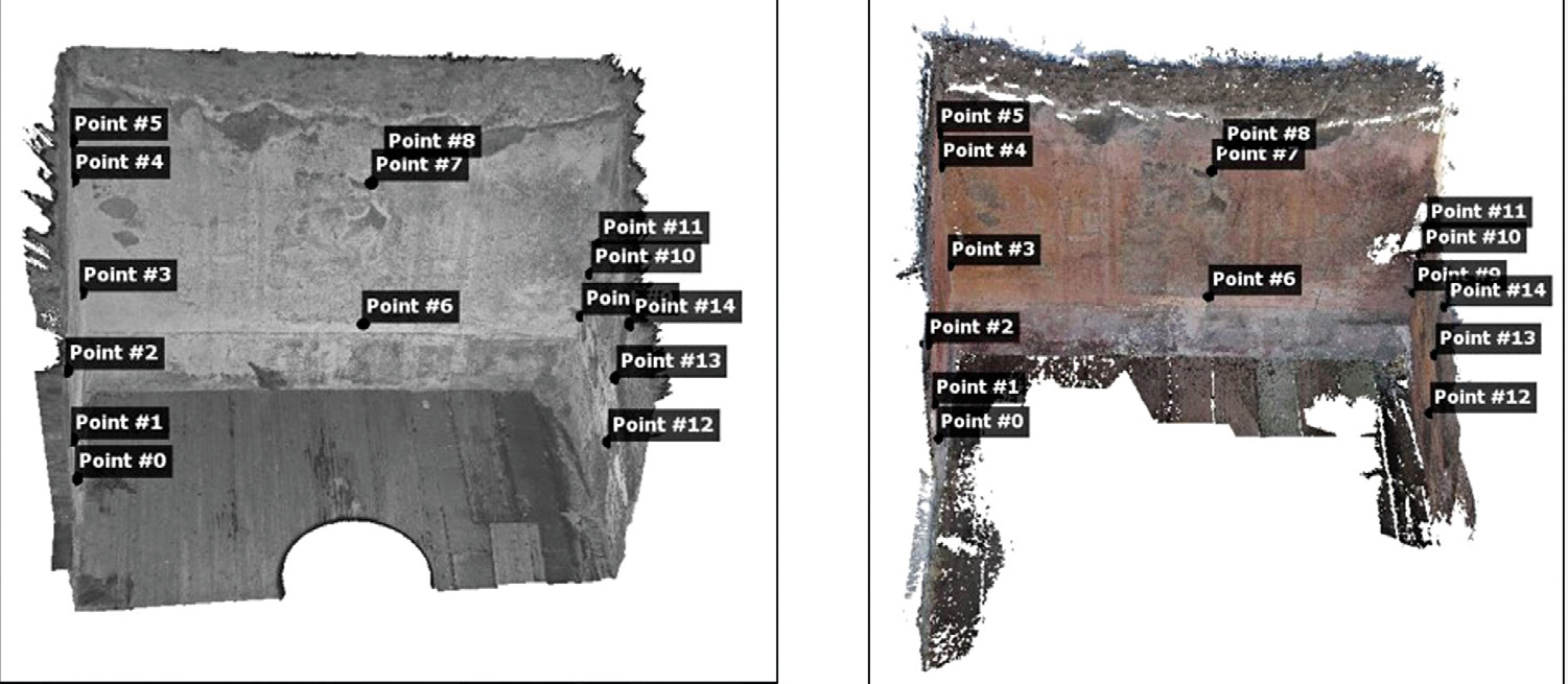
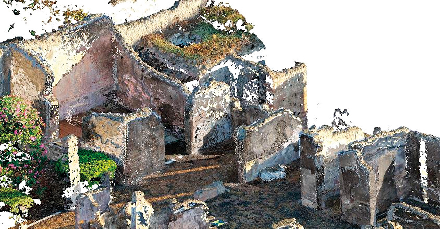
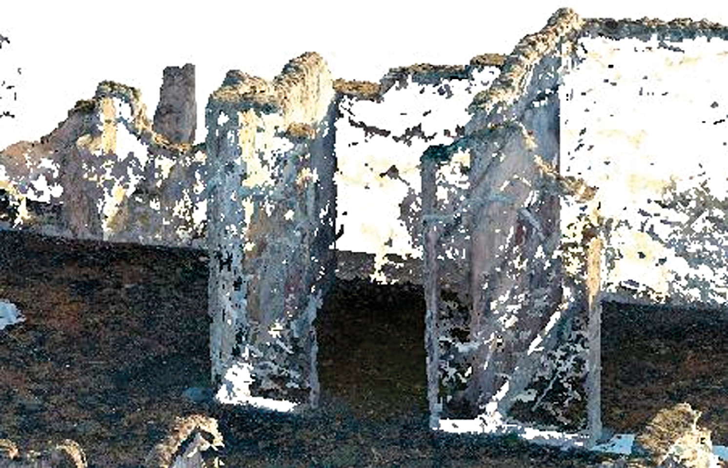
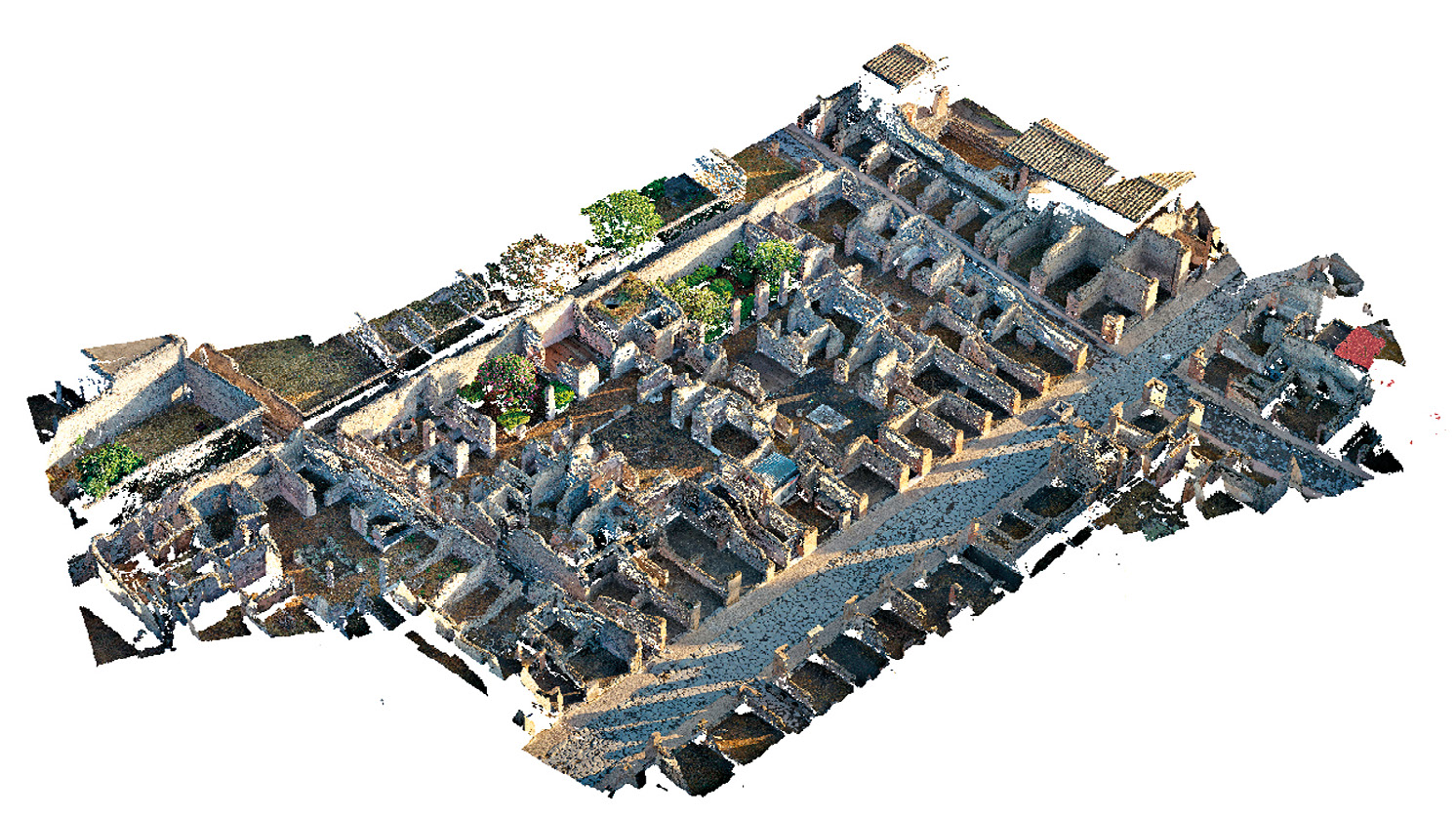
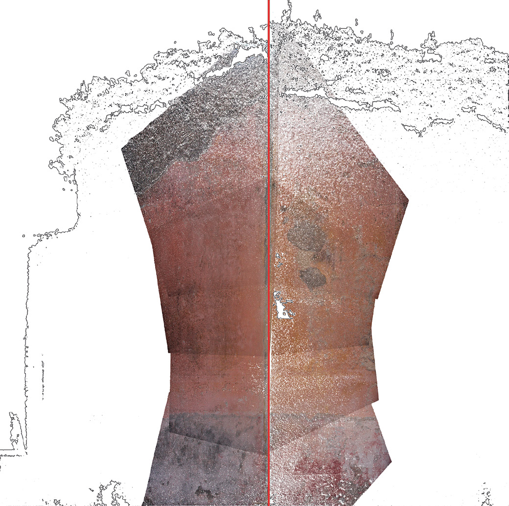
This work arises from the collaboration between the Laboratory of Archaeological Research Methodologies and the Laboratory of Geomatics of the University of Genoa, based on a multidisciplinary approach, combining archaeological and engineering skills. Since 2016, the team of archaeologists from the University of Genoa has been working inside the Pompeii Archaeological Park in the shops of insula 14 of Regio VII, an important area within the urban context as it overlooks Via dell’Abbondanza, the most important road, and it is located in a central position, in proximity to the main public areas, such as the Forum. From the beginning of the project to the present day, the archaeology team has analysed the tabernae from a stratigraphic point of view. So, simultaneously with the excavation activity, a stratigraphic analysis of the walls and coatings was carried out, involving both the commercial establishments being excavated and the three large houses of the insula, mainly focusing on the most western one, named ‘Casa della Regina d’Inghilterra’. In September 2020, a survey campaign was carried out by geomatics engineers aiming to applying innovative survey methodologies to the architectural complex of the entire insula and, specifically, to the ‘Casa della Regina d’Inghilterra’. In particular, the survey data were collected by total station, GNSS, laser scanner, combined with terrestrial and UAV photogrammetry. This paper presents the preliminary results obtained from the geomatic survey campaign, leading to the creation of an accurate photogrammetric model which can be used as a basis for a reconstructive model, whose hypotheses will be confirmed or denied by a future structural analysis.
Figures
Preview