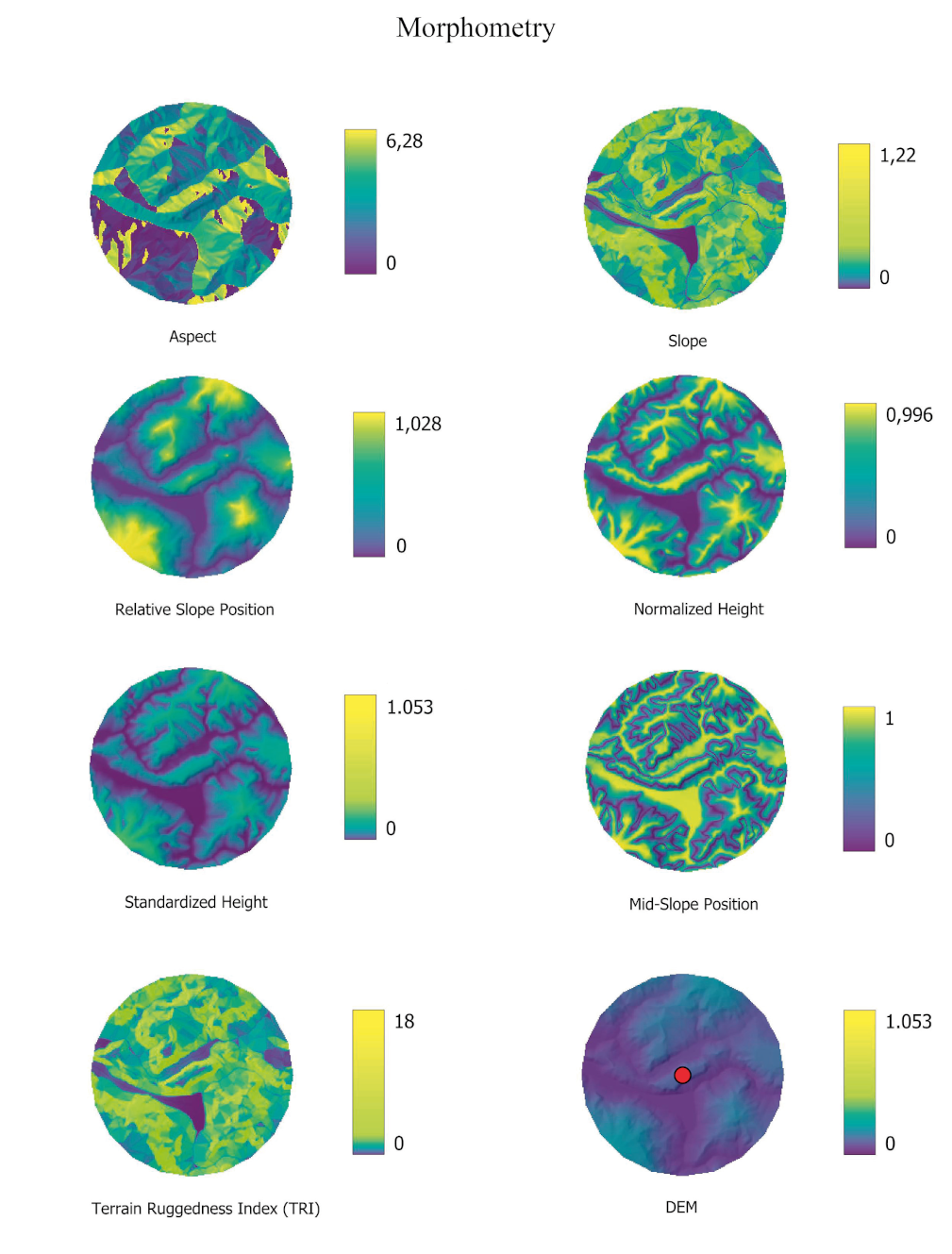
Cardarelli 2023, fig. 3
Related article: Cardarelli L. 2023, Defining Southern Etruria Final Bronze Age settlement models using an integrated GIS and Machine Learning approach, «Archeologia e Calcolatori», 34.2, 51-68 (https://doi.org/10.19282/ac.34.2.2023.03)
Caption
Illustration of the raster predictors related to the morphometry macro-class used for the analysis. The example context is Luni sul Mignone and the displayed area corresponds to the 1 km buffer around the site (its position is indicated by the red marker in the DEM grid)
Image preview
This website uses only technical cookies strictly necessary for its proper functioning. It doesn't perform any profiling and doesn't use third party cookies of any kind.
Read our privacy policy for additional information.
By clicking 'OK' or closing this banner you acknowledge having read this information and accept the website's contents.