Bödőcs 2023, fig. 3
Related article: Bödőcs A. 2023, Roman land use and its impact on the Pannonian landscape, «Archeologia e Calcolatori», 34.1, 289-298 (https://doi.org/10.19282/ac.34.1.2023.31)
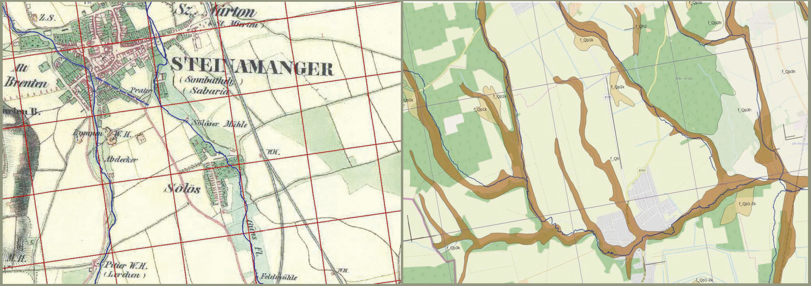
Caption
The Habsburg military survey showing the 19th watercourses S from the Roman colony with the centuriatio grid (left); the sediment map of the Ják-Sorok region shows the alluvial soil corresponding to the centuriatio grid (right)
Source
a. Bödőcs A., Kovács G. 2011, A római kori birtokrendszer kialakítása és tájformáló hatása Pannoniában. «Geodézia és Kartográfia», 63.3, 20-25; b. András Bödőcs
Image preview
This website uses only technical cookies strictly necessary for its proper functioning. It doesn't perform any profiling and doesn't use third party cookies of any kind.
Read our privacy policy for additional information.
By clicking 'OK' or closing this banner you acknowledge having read this information and accept the website's contents.