Miccoli 2022, fig. 7
Related article: Miccoli I. 2022, Applicazioni GIS e di remote sensing satellitare per la conoscenza e il monitoraggio dell’area urbana di Falerii Novi e del territorio circostante, «Archeologia e Calcolatori», 33.2, 175-196 (https://doi.org/10.19282/ac.33.2.2022.10)
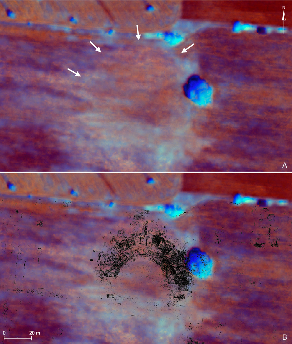
Caption
A) Tracce del teatro nel prodotto di data fusion della WorldView-2 del 2011 (R=PAN + G=NIR + B=NDVI); B) visualizzazione integrata del prodotto satellitare e delle strutture del teatro individuate nelle prospezioni GPR (anomalie in nero: da Verdonck et al. 2020, fig. 4 - “Falerii Novi_field 4” time slices da 13-14 ns a 23-24 ns - Archaeology Data Service https://archaeologydataservice. ac.uk/archives/view/romancities_ahrc_2019/).
Source
GPR layer (in dark): “Falerii Novi_field 4” - Archaeology Data Service https://archaeologydataservice.ac.uk/archives/view/romancities_ahrc_2019/
Image preview
This website uses only technical cookies strictly necessary for its proper functioning. It doesn't perform any profiling and doesn't use third party cookies of any kind.
Read our privacy policy for additional information.
By clicking 'OK' or closing this banner you acknowledge having read this information and accept the website's contents.