Miccoli 2022, fig. 2
Related article: Miccoli I. 2022, Applicazioni GIS e di remote sensing satellitare per la conoscenza e il monitoraggio dell’area urbana di Falerii Novi e del territorio circostante, «Archeologia e Calcolatori», 33.2, 175-196 (https://doi.org/10.19282/ac.33.2.2022.10)
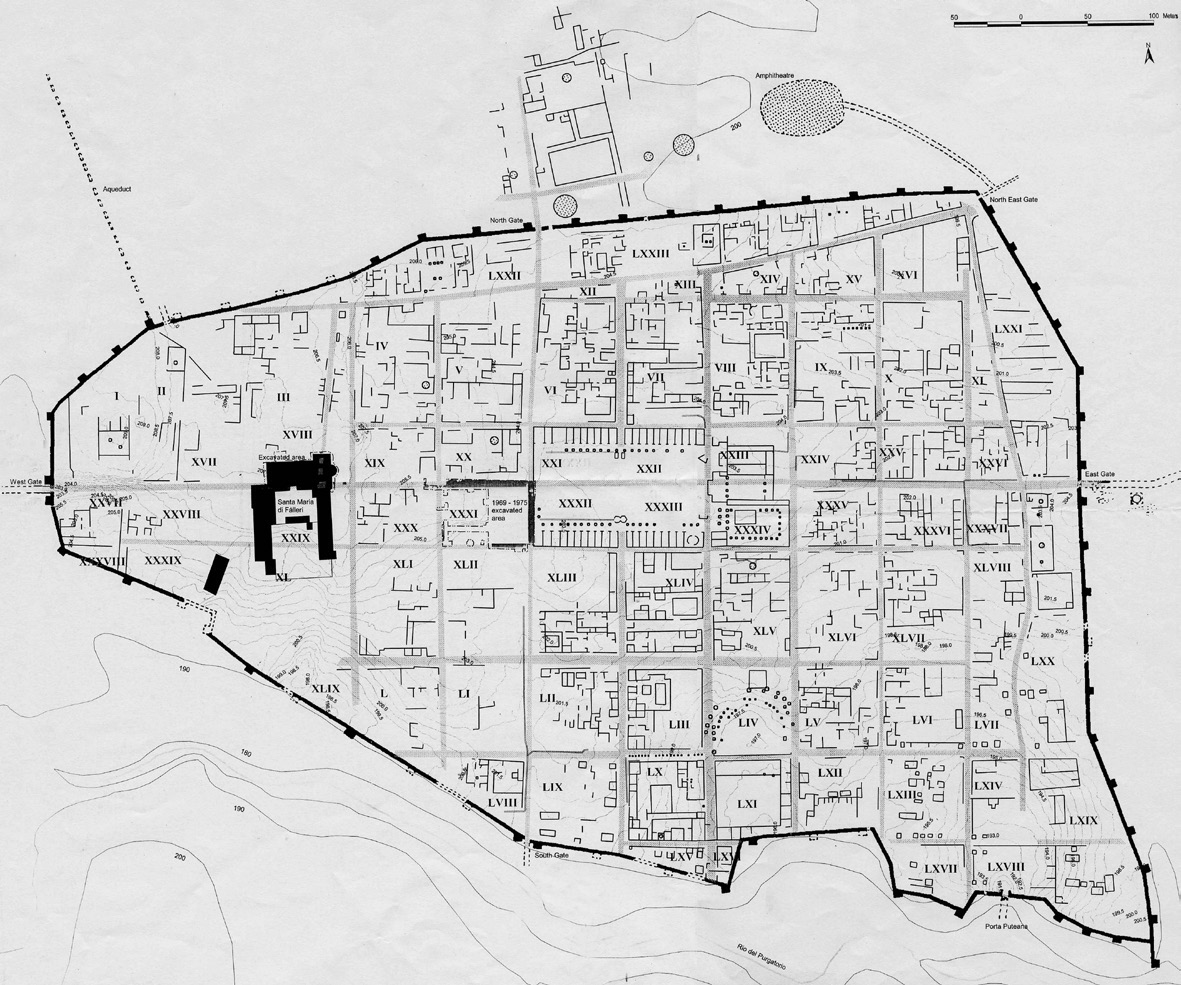
Caption
Planimetria della città di Falerii Novi elaborata sulla base delle prospezioni geofisiche condotte tra il 1997 e il 1998 (Keay et al. 2000, fig. 7).
Source
Keay S., Millett M., Poppy S., Robinson J., Taylor J., Terrenato N. 2000, Falerii Novi: a new survey of the walled area, «Papers of the British School at Rome», 68, fig. 7.
Image preview
This website uses only technical cookies strictly necessary for its proper functioning. It doesn't perform any profiling and doesn't use third party cookies of any kind.
Read our privacy policy for additional information.
By clicking 'OK' or closing this banner you acknowledge having read this information and accept the website's contents.