Cacciari, Pocobelli 2021, fig. 7
Related article: Cacciari I., Pocobelli G. F. 2021, The contribution of artificial intelligence to aerial photointerpretation of archaeological sites: a comparison between traditional and Machine Learning methods, «Archeologia e Calcolatori», 32.1, 81-98 (https://doi.org/10.19282/ac.32.1.2021.05)
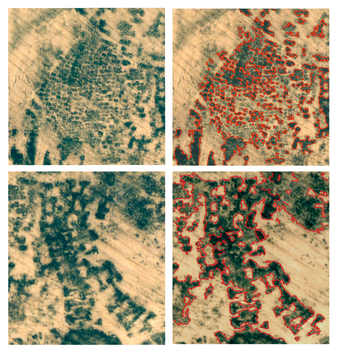
Caption
Vulci. Poggio Mengarelli. Aerial original image: details of cropmarks of pit tombs and chamber tombs (left); with ML outlines (right).
Source
Pocobelli G.F. 2003, Ortofotopiano storico del territorio di Vulci, in Guaitoli M. (ed.), Lo sguardo di Icaro. Le collezioni dell’Aerofototeca Nazionale per la conoscenza del territorio, Catalogo della mostra, Roma, Campisano Editore, 147-156.
Image preview
This website uses only technical cookies strictly necessary for its proper functioning. It doesn't perform any profiling and doesn't use third party cookies of any kind.
Read our privacy policy for additional information.
By clicking 'OK' or closing this banner you acknowledge having read this information and accept the website's contents.