Cacciari, Pocobelli 2021, fig. 1
Related article: Cacciari I., Pocobelli G. F. 2021, The contribution of artificial intelligence to aerial photointerpretation of archaeological sites: a comparison between traditional and Machine Learning methods, «Archeologia e Calcolatori», 32.1, 81-98 (https://doi.org/10.19282/ac.32.1.2021.05)
Caption
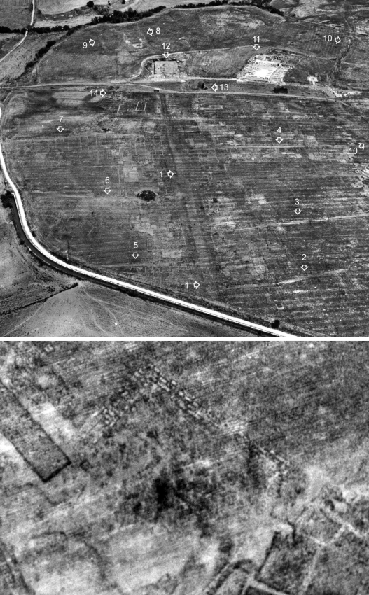
Vulci. Top: the 1975 perspective photograph showing the marks of the city’s urban plan as seen from the S. Clearly visible are the main NS road (1) and the secondary roads that delimit the blocks (2-9). Around the large dark area of the “Foro Occidentale” are the “Tempio Grande” (12), the “Edificio Absidato” (13), the “Edificio in Laterizio” (14), on the right, the “Domus del Criptoportico” (11) and the so-called “Cardine Massimo” (10). Bottom: detail of the 1975 perspective photo with traces of the Etruscan temple in opus quadratum at the so-called “Foro Orientale” (Pocobelli 2011).
Source
Pocobelli G.F. 2011, Vulci e il suo territorio: area urbana, necropoli e viabilità. Applicazioni di cartografia archeologica e fotogrammetria finalizzata, in G. Ceraudo (ed.), 100 anni di archeologia aerea in Italia. Atti del I Convegno Internazionale (Roma 2009), Foggia, Claudio Grenzi Editore, 117-126.
Image preview
This website uses only technical cookies strictly necessary for its proper functioning. It doesn't perform any profiling and doesn't use third party cookies of any kind.
Read our privacy policy for additional information.
By clicking 'OK' or closing this banner you acknowledge having read this information and accept the website's contents.