Niknami, Jabarzadeh, Vahabi 2021, fig. 5
Kamal Aldin Niknami, Hayyan Jabarzadeh, Mahsa Vahabi
Related article: Niknami K. A., Jabarzadeh H., Vahabi M. 2021, Archaeological survey of the western boundary strip of Iran through using remote sensing techniques, «Archeologia e Calcolatori», 32.1, 63-80 (https://doi.org/10.19282/ac.32.1.2021.04)
Caption
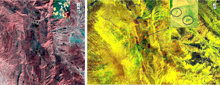
a) ASTER, Hyperion/EO-1; identification of points based on the differences in soil color in the integration of images; b) WorldView-3 SWIR, identification of positive and negative signs of vegetal coverage.
Image preview
This website uses only technical cookies strictly necessary for its proper functioning. It doesn't perform any profiling and doesn't use third party cookies of any kind.
Read our privacy policy for additional information.
By clicking 'OK' or closing this banner you acknowledge having read this information and accept the website's contents.