Garagnani 2021, fig.4
Simone Garagnani, Enrico Zampieri
Related article: Garagnani S. 2021, Quick digitization techniques: the case study of Numana necropolis, in V. Baldoni (ed.), From pottery to context. Archaeology and virtual modelling, «Archeologia e Calcolatori», 32.2, 53-62 (https://doi.org/10.19282/ac.32.2.2021.06)
Caption
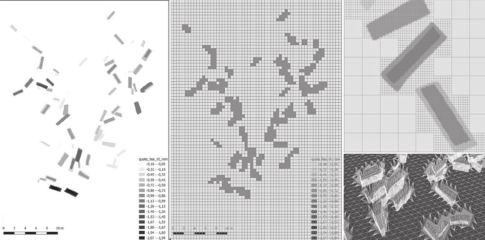
The displaced surface was triangulated to reach a better layout, in order to cover the edges of the 2D reference bitmap generated by GIS maps produced in different times. Even if this is not an accurate metric representation, it proved to be useful in 3D documentation of excavation levels, determining superimpositions over time.model scale and placed at the territorial scale in the reconstructed scenario.
Image preview
This website uses only technical cookies strictly necessary for its proper functioning. It doesn't perform any profiling and doesn't use third party cookies of any kind.
Read our privacy policy for additional information.
By clicking 'OK' or closing this banner you acknowledge having read this information and accept the website's contents.