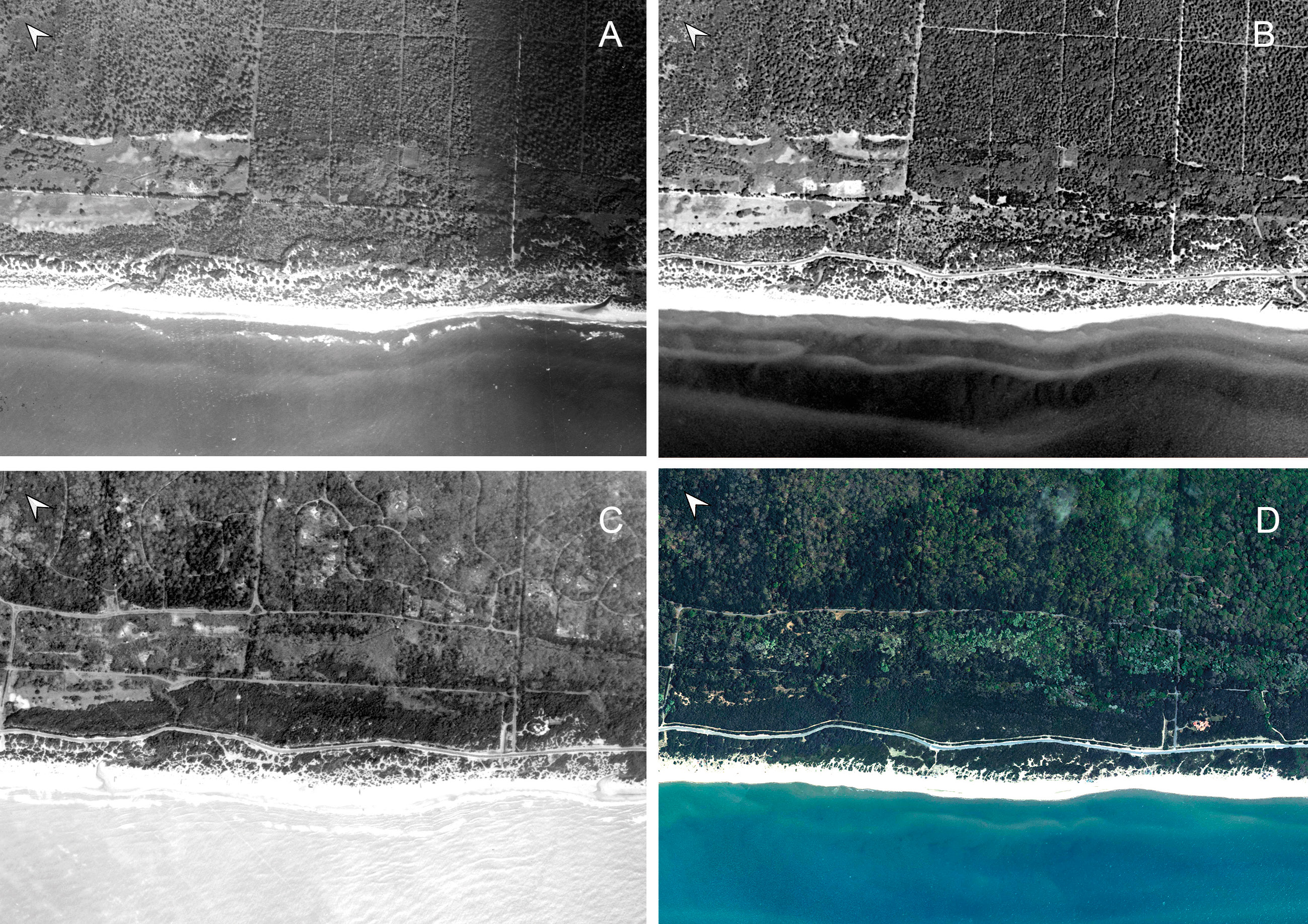
Pescari, Pocobelli 2026, fig. 10
Archivio Aerofototecanazionale
Related article: Pescari V., Pocobelli G. F. 2026, Contributi alla carta archeologica della Tenuta di Castelporziano: GIS, survey e remote sensing, in S. Campana, G. Cantoro, P. Liverani, G. F. Pocobelli (eds.), Indagini non invasive multidisciplinari per la conoscenza della topografia antica di centri urbani e del territorio, «Archeologia e Calcolatori», Supplemento 15, 15-36 (https://doi.org/10.19282/acs.15.2026.03)
Caption
A) RAF 1943, str. 501, fotogr. 4011; B) volo base 1954, ortofotomosaico; C) SARA 1984, str. 7, fotogr. 32; D) foto satellitare Bing Aerial; la successione cronologica mostra il progressivo avanzamento della copertura boschiva (Archivio AFN).
Image preview

This website uses only technical cookies strictly necessary for its proper functioning. It doesn't perform any profiling and doesn't use third party cookies of any kind.
Read our privacy policy for additional information.
By clicking 'OK' or closing this banner you acknowledge having read this information and accept the website's contents.