Brancato et al. 2025, fig. 10
Rodolfo Brancato, Antonino Bottone, Giuseppe Luongo
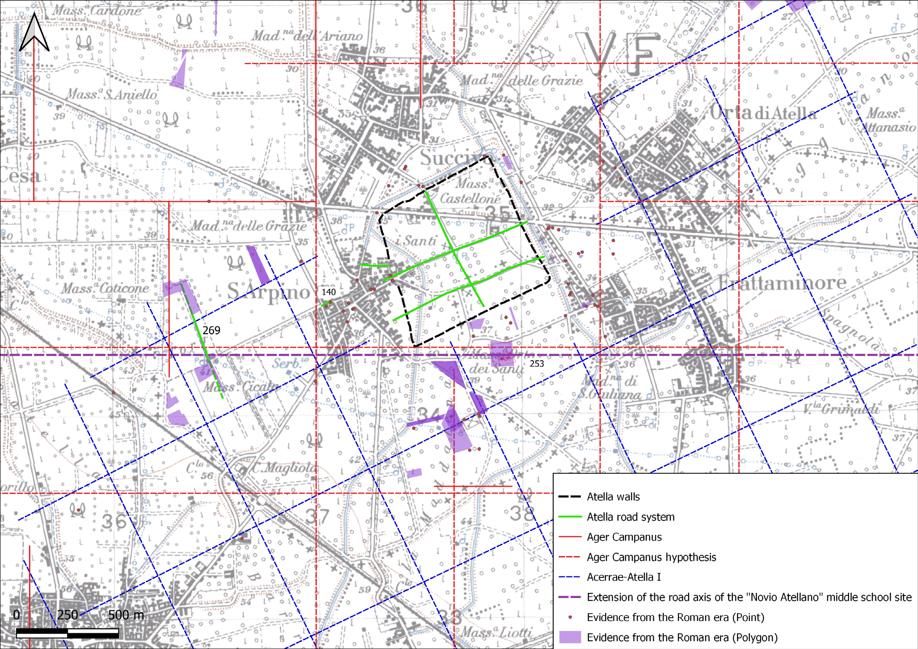
Related article: Brancato R., Bottone A., Luongo G., Tescione T. 2025, Legacy data GIS integration and surface survey for the archaeology of the Atellan landscape (Campania, Italy), in R. Brancato, V. Ferrari, I. Rossi (eds.), Investigating Resilient Roman Agricultural Landscapes in Southern Italy. An integrated and open IT approach for archaeological topography of centuriation. Proceedings of the final conference of the PRIN 2022 project ‘In.Res.Agri’ (Naples, 20th-21st November 2025), «Archeologia e Calcolatori», 36.2, 179-198 (https://doi.org/10.19282/ac.36.2.2025.15)
Caption
Extent of the road axis discovered during construction of the Frattaminore ‘Novio Atellano’ middle school, compared with the centuriation proposed by M. Monaco (1998)
Source
Monaco M. 1998, L’ager Campanus, in Atlas Historique des Cadastres d’Europe, 1, dossier IV, Luxembourg, fiche 2.
Image preview
This website uses only technical cookies strictly necessary for its proper functioning. It doesn't perform any profiling and doesn't use third party cookies of any kind.
Read our privacy policy for additional information.
By clicking 'OK' or closing this banner you acknowledge having read this information and accept the website's contents.