Di Palma, Merola 2025, fig. 4
Related article: Di Palma F., Merola P. 2025, Remote sensing techniques and Machine Learning analyses in archaeology: a methodological approach to territory investigations, in R. Brancato, V. Ferrari, I. Rossi (eds.), Investigating Resilient Roman Agricultural Landscapes in Southern Italy. An integrated and open IT approach for archaeological topography of centuriation. Proceedings of the final conference of the PRIN 2022 project ‘In.Res.Agri’ (Naples, 20th-21st November 2025), «Archeologia e Calcolatori», 36.2, 159-178 (https://doi.org/10.19282/ac.36.2.2025.14)
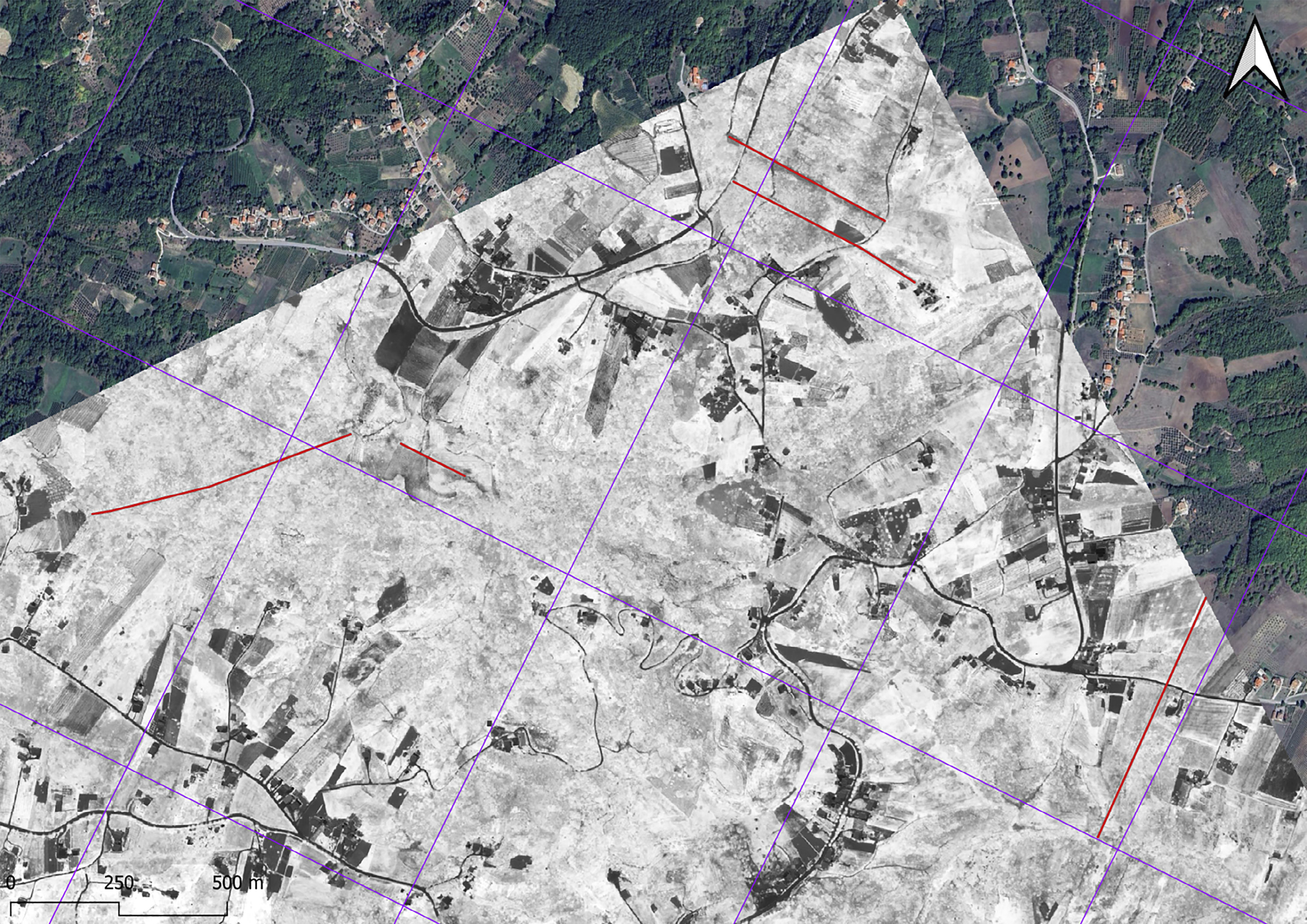
Caption
Irpinia, image WV-3 from April 26, 2018 (ID code 104001003C24FD00). Example of traces identified and associated with the grid model oriented NE-SW. The trace identification and vectorization were performed using eCognition v. 10.4 and v. 10.5, based on the SAVI index, enabling precise delineation of archaeological features in the landscape
Image preview
This website uses only technical cookies strictly necessary for its proper functioning. It doesn't perform any profiling and doesn't use third party cookies of any kind.
Read our privacy policy for additional information.
By clicking 'OK' or closing this banner you acknowledge having read this information and accept the website's contents.