Di Palma, Merola 2025, fig. 2
Related article: Di Palma F., Merola P. 2025, Remote sensing techniques and Machine Learning analyses in archaeology: a methodological approach to territory investigations, in R. Brancato, V. Ferrari, I. Rossi (eds.), Investigating Resilient Roman Agricultural Landscapes in Southern Italy. An integrated and open IT approach for archaeological topography of centuriation. Proceedings of the final conference of the PRIN 2022 project ‘In.Res.Agri’ (Naples, 20th-21st November 2025), «Archeologia e Calcolatori», 36.2, 159-178 (https://doi.org/10.19282/ac.36.2.2025.14)
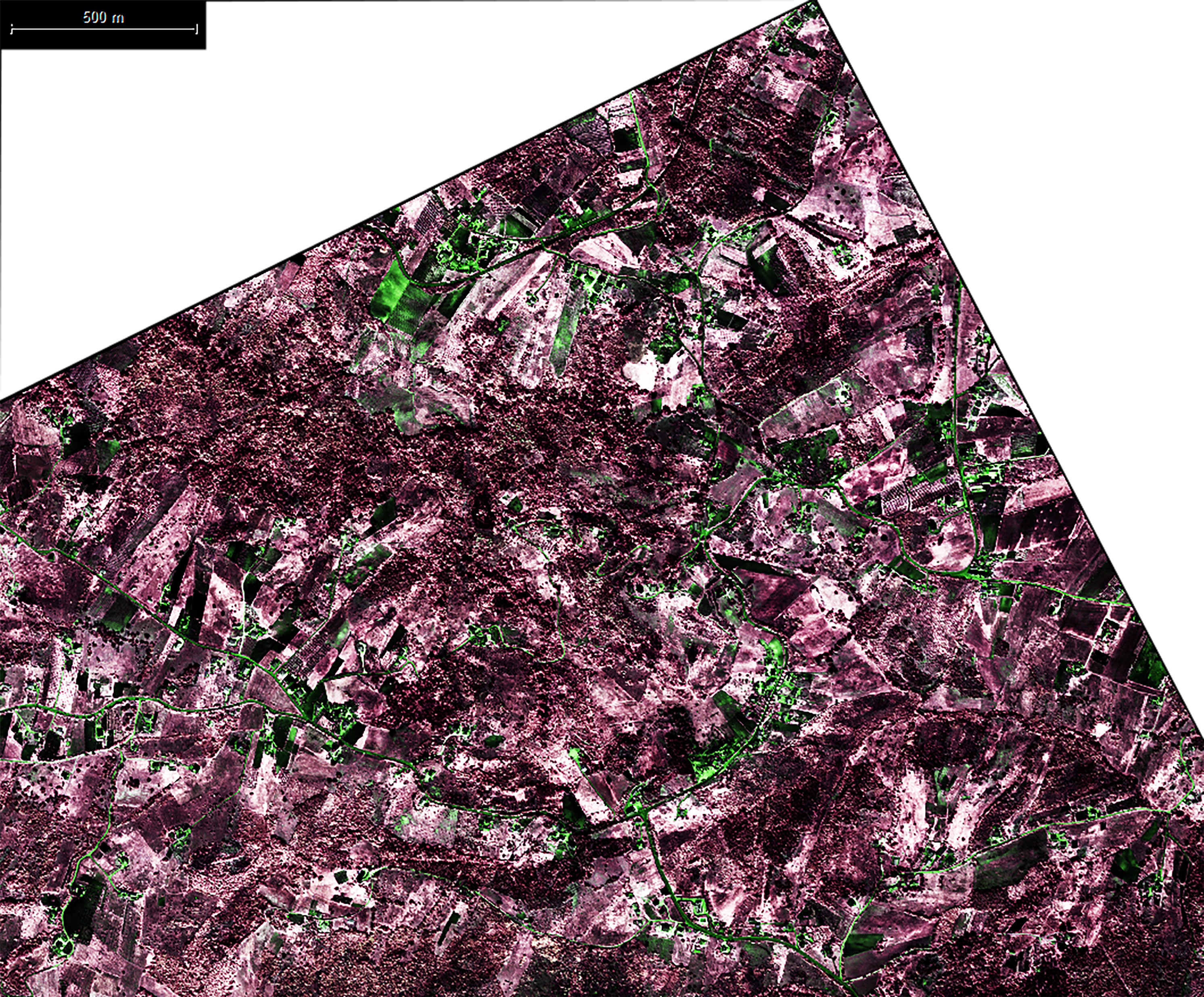
Caption
Detailed processing of the WV-3 four-band stereo satellite imagery from April 26, 2018 (ID code 104001003C24FD00). The image has been processed using a false-colour composite, with the B, G, and R channels assigned to the respective B, G, and R bands, while the Near-Infrared (NIR) band is displayed across all channels. A series of vegetation and surface indices were derived and visualized: the Normalized Difference Water Index (NDWI) in the G channel, the Simple Ratio (SR) in all channels, the Normalized Difference Vegetation Index (NDVI) in the B channel, the Green Ratio Vegetation Index (GRVI) in the R channel, the Normalized Difference Soil Index (NDSI) in the B channel, and the Normalized NIR (NormNIR) in the R channel
Image preview
This website uses only technical cookies strictly necessary for its proper functioning. It doesn't perform any profiling and doesn't use third party cookies of any kind.
Read our privacy policy for additional information.
By clicking 'OK' or closing this banner you acknowledge having read this information and accept the website's contents.