Serlorenzi et. al. 2024, fig. 5
Ascanio D'Andrea, Paolo Rosati
Related article: Serlorenzi M., D'Andrea A., Rosa C., Rosati P., Sepio D. 2024, Preliminary results of the archaeological potential map in SITAR, in R. Brancato, J. Bogdani, V. Vitale (eds.), Linking Pasts and Sharing Knowledge. Mapping Archaeological Heritage, Legacy Data Integration and Web Technologies for Modelling Historical Landscapes (Naples, 13th-14th November 2023), «Archeologia e Calcolatori», 35.2, 285-298 (https://doi.org/10.19282/ac.35.2.2024.31)
Caption
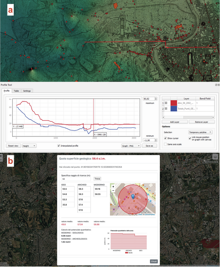
a) Current surface (red) and geological surface (blue). The section crosses St. Peter’s Basilica, then piazza Pia, crosses the Tiber at Ponte Elio, and ends at via del Corso (Via Lata); b) the SITAR prototype of the webGIS tool for sampling quantitative archaeological potential in Rome. The tool averages the elevations within a search radius around the clicked point; in this case, the click was made at Termini (map and section processing by Paolo Rosati, webGIS application by Ascanio D’Andrea)
Image preview
This website uses only technical cookies strictly necessary for its proper functioning. It doesn't perform any profiling and doesn't use third party cookies of any kind.
Read our privacy policy for additional information.
By clicking 'OK' or closing this banner you acknowledge having read this information and accept the website's contents.