Serlorenzi et. al. 2024, fig. 1
Related article: Serlorenzi M., D'Andrea A., Rosa C., Rosati P., Sepio D. 2024, Preliminary results of the archaeological potential map in SITAR, in R. Brancato, J. Bogdani, V. Vitale (eds.), Linking Pasts and Sharing Knowledge. Mapping Archaeological Heritage, Legacy Data Integration and Web Technologies for Modelling Historical Landscapes (Naples, 13th-14th November 2023), «Archeologia e Calcolatori», 35.2, 285-298 (https://doi.org/10.19282/ac.35.2.2024.31)
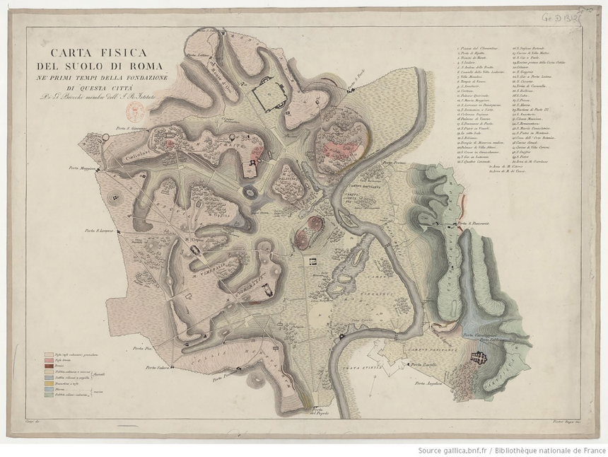
Caption
The Carta fisica del suolo di Roma nei primi tempi della fondazione di questa città by Giovan Battista Brocchi in 1820 has been rotated 180° to facilitate geographic reading since the original is oriented South instead of North
Source
Brocchi 1920, Carta fisica del suolo di Roma nei primi tempi della fondazione di questa città
Image preview
This website uses only technical cookies strictly necessary for its proper functioning. It doesn't perform any profiling and doesn't use third party cookies of any kind.
Read our privacy policy for additional information.
By clicking 'OK' or closing this banner you acknowledge having read this information and accept the website's contents.