Azzari, Liverani 2024, fig. 5
Related article: Azzari M., Liverani P. 2024, Landscape visualisation and modelling, in R. Brancato, J. Bogdani, V. Vitale (eds.), Linking Pasts and Sharing Knowledge. Mapping Archaeological Heritage, Legacy Data Integration and Web Technologies for Modelling Historical Landscapes (Naples, 13th-14th November 2023), «Archeologia e Calcolatori», 35.2, 277-284 (https://doi.org/10.19282/ac.35.2.2024.30)
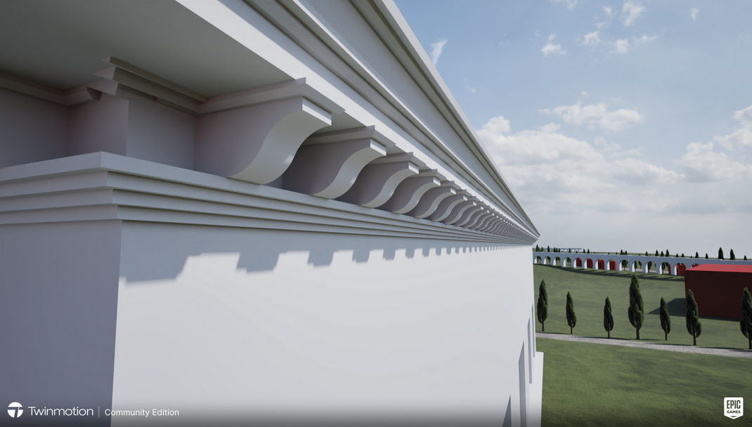
Caption
A 3D rendering of the Lateran area during the Severan period. The surface model was created using the IDW method in ArcGIS pro, then imported into ArcGIS City Engine and into Twinmotion for rendering. The building in the foreground was created using 3D Studio Max (Iwan Peverett & Thea Ravasi) and imported into Twinmotion
Image preview
This website uses only technical cookies strictly necessary for its proper functioning. It doesn't perform any profiling and doesn't use third party cookies of any kind.
Read our privacy policy for additional information.
By clicking 'OK' or closing this banner you acknowledge having read this information and accept the website's contents.