Luongo 2024, fig. 5
Giuseppe Luongo, Rodolfo Brancato
Related article: Luongo G. 2024, GIS integration of heterogeneous data for the archaeological topography of the ‘Acquedotto del Paradiso’, Syracuse, in R. Brancato, J. Bogdani, V. Vitale (eds.), Linking Pasts and Sharing Knowledge. Mapping Archaeological Heritage, Legacy Data Integration and Web Technologies for Modelling Historical Landscapes (Naples, 13th-14th November 2023), «Archeologia e Calcolatori», 35.2, 431-444 (https://doi.org/10.19282/ac.35.2.2024.45)
Caption
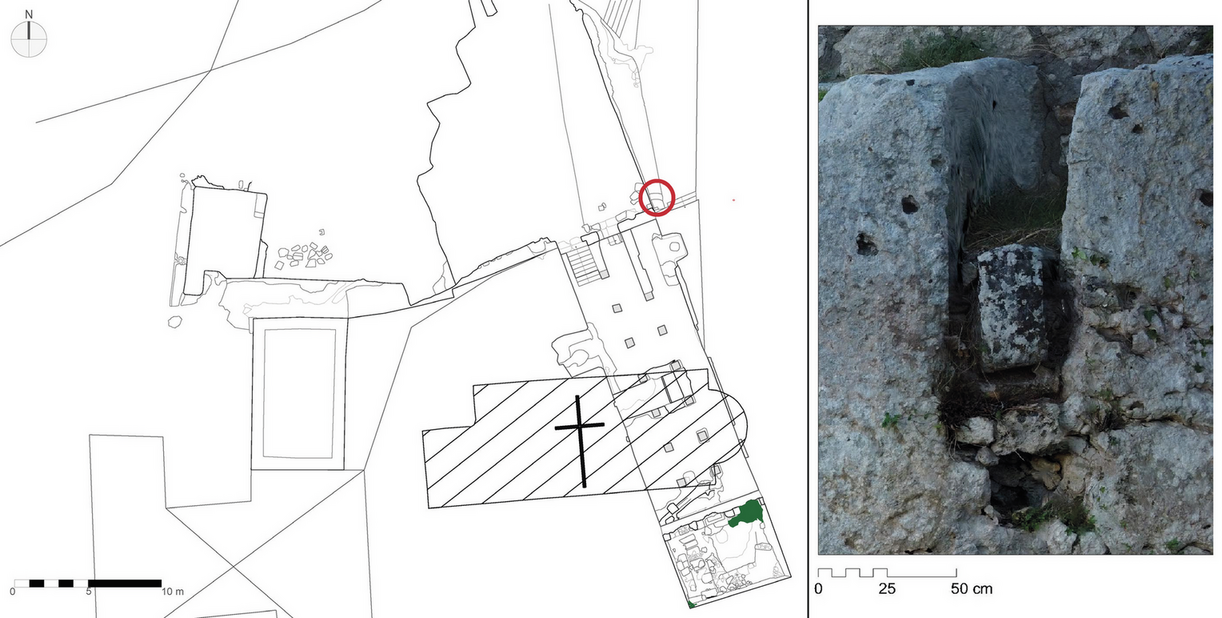
New plan of the Piscina di San Nicolò ai Cordari and its surroundings. The red circle highlights the channel that fed the cistern. On the right, a detailed elevation view of that channel (courtesy of Parco archeologico e paesaggistico di Siracusa, Eloro, Villa del Tellaro e Akrai)
Image preview
This website uses only technical cookies strictly necessary for its proper functioning. It doesn't perform any profiling and doesn't use third party cookies of any kind.
Read our privacy policy for additional information.
By clicking 'OK' or closing this banner you acknowledge having read this information and accept the website's contents.