Luongo 2024, fig. 4
Related article: Luongo G. 2024, GIS integration of heterogeneous data for the archaeological topography of the ‘Acquedotto del Paradiso’, Syracuse, in R. Brancato, J. Bogdani, V. Vitale (eds.), Linking Pasts and Sharing Knowledge. Mapping Archaeological Heritage, Legacy Data Integration and Web Technologies for Modelling Historical Landscapes (Naples, 13th-14th November 2023), «Archeologia e Calcolatori», 35.2, 431-444 (https://doi.org/10.19282/ac.35.2.2024.45)
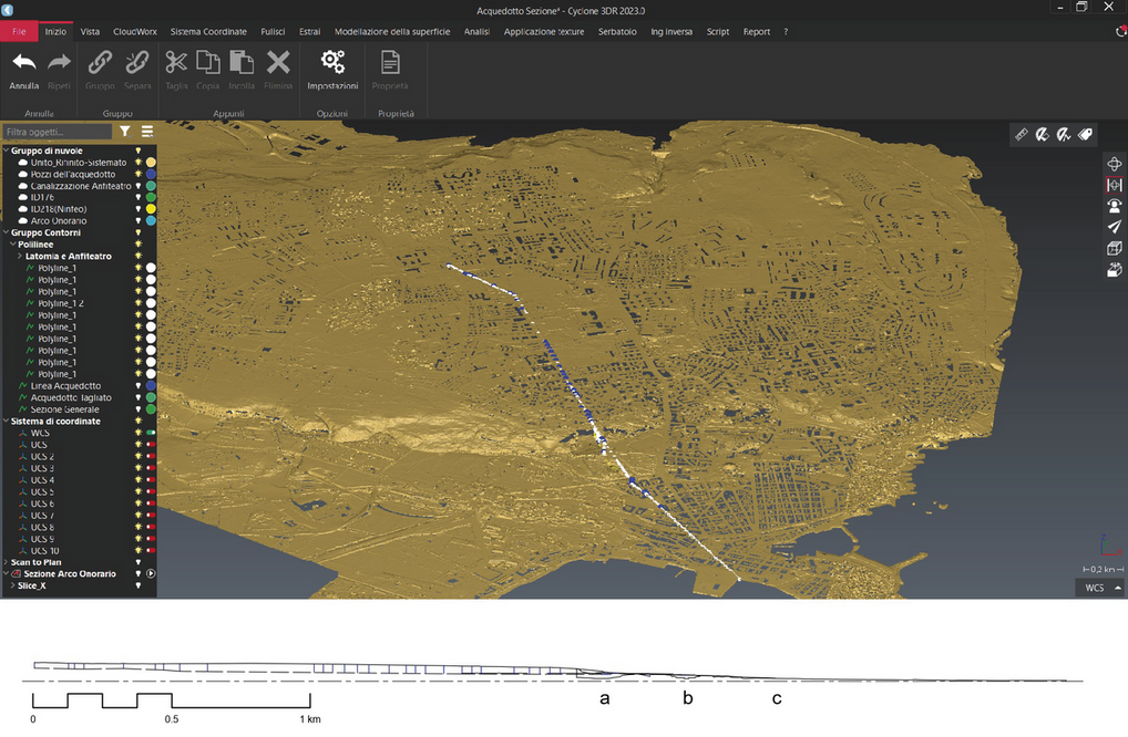
Caption
At the top, a snapshot from Leica Cyclone 3DR showing the interpolated point cloud of the Syracuse plateau, with the route of the Acquedotto del Paradiso in white and the wells in blue. Below, the section obtained in AutoCAD after completing the process: a) Latomia del Paradiso; b) Roman amphitheater; c) Foro triangolare
Image preview
This website uses only technical cookies strictly necessary for its proper functioning. It doesn't perform any profiling and doesn't use third party cookies of any kind.
Read our privacy policy for additional information.
By clicking 'OK' or closing this banner you acknowledge having read this information and accept the website's contents.