Brancato et al. 2024, fig. 3
Giuseppe Scardozzi, Rodolfo Brancato
Related article: Brancato R., Ferrari V., Ditaranto I., Merola P., Rossi I. 2024, Investigating resilient Roman agricultural landscapes in southern Italy. An integrated and open IT approach to modeling centuriation, in R. Brancato, J. Bogdani, V. Vitale (eds.), Linking Pasts and Sharing Knowledge. Mapping Archaeological Heritage, Legacy Data Integration and Web Technologies for Modelling Historical Landscapes (Naples, 13th-14th November 2023), «Archeologia e Calcolatori», 35.2, 387-400 (https://doi.org/10.19282/ac.35.2.2024.41)
Caption
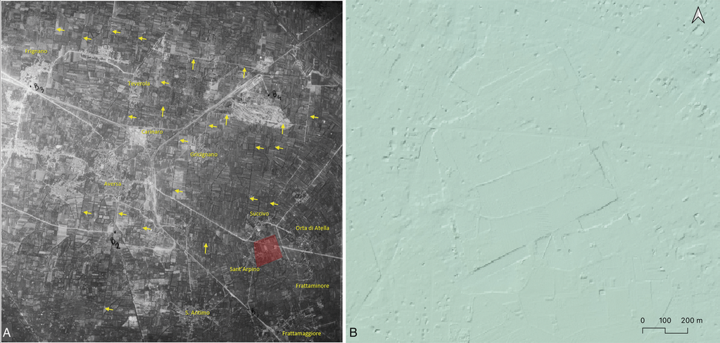
Atella and its territory (case study 1) as seen in a historical aerial photograph (RAF 1945) annotated by G. Scardozzi (A) and in the DTM with a 1-meter ground resolution derived from LiDAR scanning acquired by the Ministry of the Environment of Italy
Source
BRANCATO R., BARONE P.M., SCARDOZZI G., 2023, Non-invasive archaeological research in Atella (Sant’Arpino-Campania, Italy). Preliminary results from the 2023 campaign, «Cronache di Archeologia», 40, 397-418.
Image preview
This website uses only technical cookies strictly necessary for its proper functioning. It doesn't perform any profiling and doesn't use third party cookies of any kind.
Read our privacy policy for additional information.
By clicking 'OK' or closing this banner you acknowledge having read this information and accept the website's contents.