Brancato et al. 2024, fig. 2
Clara Bencivenga Trillmich, Rodolfo Brancato
Related article: Brancato R., Ferrari V., Ditaranto I., Merola P., Rossi I. 2024, Investigating resilient Roman agricultural landscapes in southern Italy. An integrated and open IT approach to modeling centuriation, in R. Brancato, J. Bogdani, V. Vitale (eds.), Linking Pasts and Sharing Knowledge. Mapping Archaeological Heritage, Legacy Data Integration and Web Technologies for Modelling Historical Landscapes (Naples, 13th-14th November 2023), «Archeologia e Calcolatori», 35.2, 387-400 (https://doi.org/10.19282/ac.35.2.2024.41)
Caption
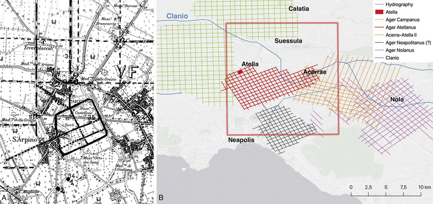
The site of Atella and its hypothesized cadastral layout (case study 1) plotted on a 1:25,000 scale topographic map (A) and within the broader context of Campania region (B)
Source
BENCIVENGA TRILLMICH C. 1984, Risultati delle più recenti indagini archeologiche nell’area dell’antica Atella, «Rendiconti della Accademia di archeologia, lettere e belle arti di Napoli», 59, 3-26
Image preview
This website uses only technical cookies strictly necessary for its proper functioning. It doesn't perform any profiling and doesn't use third party cookies of any kind.
Read our privacy policy for additional information.
By clicking 'OK' or closing this banner you acknowledge having read this information and accept the website's contents.