Naso et al. 2024, fig. 5
Related article: Naso A., Brancato R., Zinni M., Amici S. 2024, Application of integrated 3D survey technologies in an Etruscan necropolis: the case of Sasso Pinzuto (Tuscania, VT), «Archeologia e Calcolatori», 35.1, 389-406 (https://doi.org/10.19282/ac.35.1.2024.24)
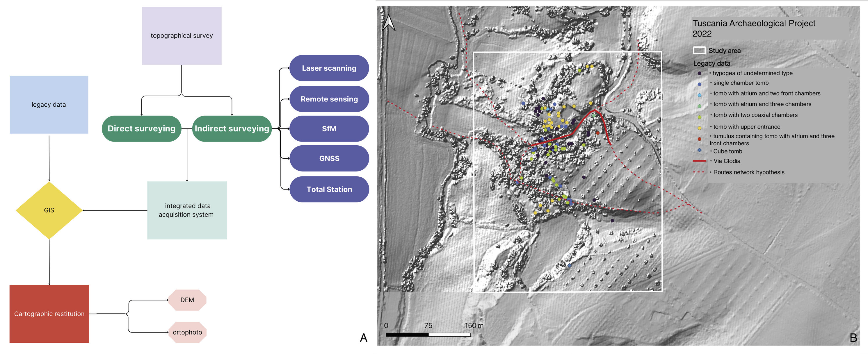
Caption
A) Diagram of the topographic data integration process; B) Sasso Pinzuto-Tuscania (in white): archaeological legacy data available for the site pletted on a topographic basis obtained from a 1 m LiDAR Composite DTM (2013, Ministero dell’Ambiente e della Tutela del territorio e del mare) in the GIS created for the project
Image preview
This website uses only technical cookies strictly necessary for its proper functioning. It doesn't perform any profiling and doesn't use third party cookies of any kind.
Read our privacy policy for additional information.
By clicking 'OK' or closing this banner you acknowledge having read this information and accept the website's contents.