Da Villa et al. 2024, fig. 7
Related article: Da Villa G. A., Zara A., Faresin E., Bonetto J., Miele C., Persichetti A. 2024, Methods and tools for generating the DTM of an archaeological site: the case-study of the photogrammetric survey of Nora (Sardinia, Italy), «Archeologia e Calcolatori», 35.1, 369-388 (https://doi.org/10.19282/ac.35.1.2024.23)
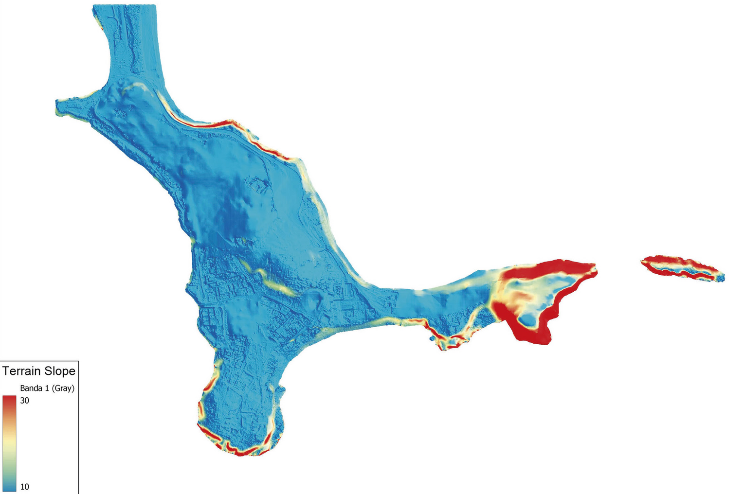
Caption
The slope map of the peninsula shows the main changes in slope at the erosion fronts. The overburden of the so-called Kasbah is in the centre of the peninsula and is highlighted in red
Image preview
This website uses only technical cookies strictly necessary for its proper functioning. It doesn't perform any profiling and doesn't use third party cookies of any kind.
Read our privacy policy for additional information.
By clicking 'OK' or closing this banner you acknowledge having read this information and accept the website's contents.