Montesanto 2024, fig. 5
Related article: Montesanto M. 2024, From the river to the sea of the setting sun: route networks between the Euphrates and the Mediterranean during the Iron Age (1200-600 BCE), «Archeologia e Calcolatori», 35.1, 251-268 (https://doi.org/10.19282/ac.35.1.2024.17)
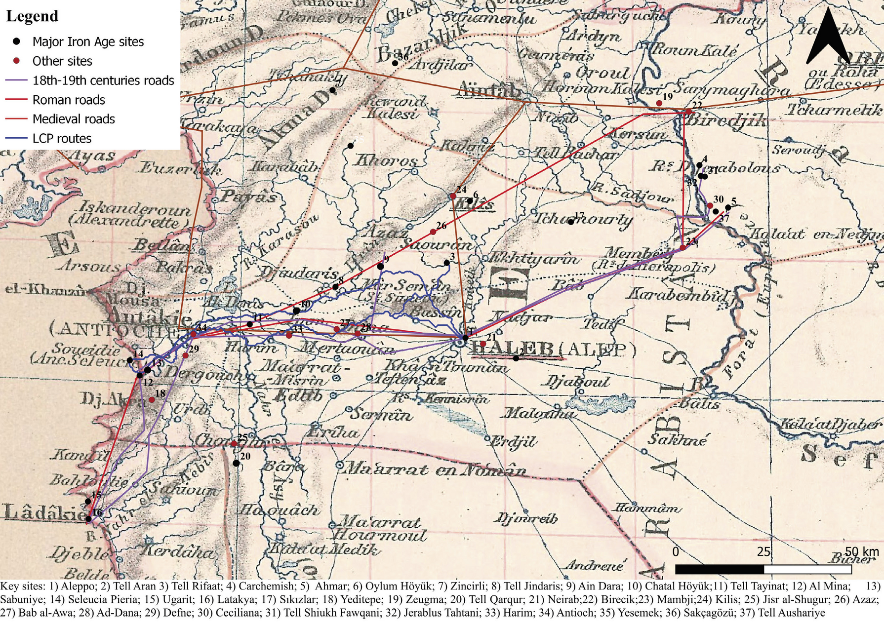
Caption
Map drawn by Kiepert (1903) with Roman, medieval and modern roads and LCPs results
Source
Kiepert H. 1903, Mesopotamia. Asia citerior, Berlin, Geographische Verlagshandlung Dietrich Reimer (Ernst Vohsen).
Image preview
This website uses only technical cookies strictly necessary for its proper functioning. It doesn't perform any profiling and doesn't use third party cookies of any kind.
Read our privacy policy for additional information.
By clicking 'OK' or closing this banner you acknowledge having read this information and accept the website's contents.