Renda G., Civale C., Mataluna S., Cofrancesco P. 2024, The GISTArc webGIS for the accessibility and sharing of archaeological data in Campania, in R. Brancato, J. Bogdani, V. Vitale (eds.), Linking Pasts and Sharing Knowledge. Mapping Archaeological Heritage, Legacy Data Integration and Web Technologies for Modelling Historical Landscapes (Naples, 13th-14th November 2023), «Archeologia e Calcolatori», 35.2, 299-310 (https://doi.org/10.19282/ac.35.2.2024.32)
Copy to clipboard Download: BibTeXThe GISTArc webGIS for the accessibility and sharing of archaeological data in Campania
Giuseppina Renda, Carmine Civale, Sabrina Mataluna, Pacifico Cofrancesco
«Archeologia e Calcolatori» 2024, 35.2, 299-310; doi: 10.19282/ac.35.2.2024.32
Abstract
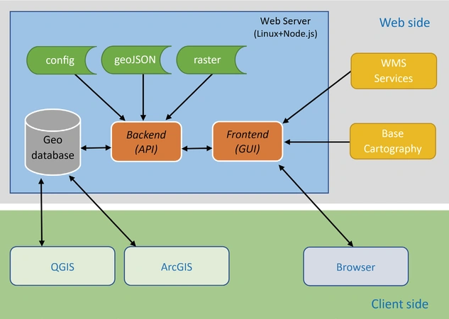
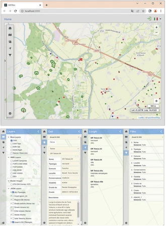
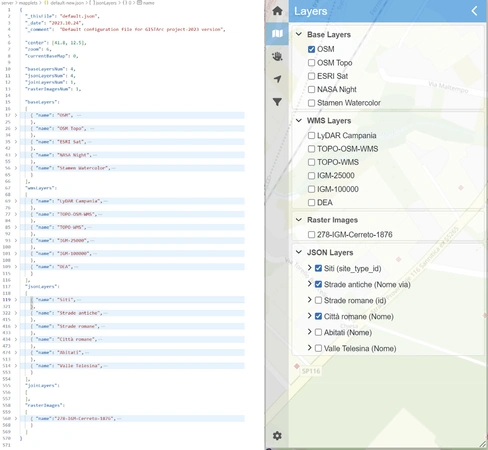
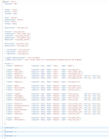
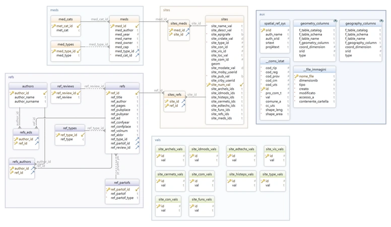
The GISTArc project envisions the implementation of a webGIS environment for the management and visualization of geoarchaeological data from research included in the Archaeological Map of Northern Campania project, conceived and directed by Stefania Quilici Gigli. The creation of the new system began with the normalization of some completed research data. They were managed in a GIS environment and were subsequently imported into a Web geodatabase, with the preparation of layers containing all the textual, graphical/ photographical and spatial information of the catalogued archaeological evidence, together with the required bibliographical references. The GISTArc project has a threefold aim: make the results of archaeological research conducted in some sectors of northern Campania more usable; allow the researcher to consult, integrate and enter the data from future research, thanks to the connection to the system via the Internet and the possibility of recording data directly during the survey; and finally access via standard desktop applications, such as Quantum GIS and ArcGIS, rather than the internet-based GISTArc geodatabase, in order to use advanced data analysis and representation functions that may not be available online. This paper describes the technical and scientific approach to the creation of our webGIS. It focuses on the system architecture, operative environment, and development tools.
Figures
Preview
Subjects:
GIS and cartography Cultural Resource Management
Download (PDF)Publishers:
CNR - Istituto di Scienze del Patrimonio Culturale
Edizioni All'Insegna del Giglio
This website uses only technical cookies strictly necessary for its proper functioning. It doesn't perform any profiling and doesn't use third party cookies of any kind.
Read our privacy policy for additional information.
By clicking 'OK' or closing this banner you acknowledge having read this information and accept the website's contents.

