Rinaldi F., Lugari A., Sposito F., D'Andrea A. 2023, Archeology and conservation. Digital tools as digital bridges between disciplines: the risk map of the in situ mosaic and marble floor surfaces of the Parco Archeologico del Colosseo, in J. Bogdani, S. Costa (eds.), ArcheoFOSS 2022. Proceedings of the 16th International Conference on Open Software, Hardware, Processes, Data and Formats in Archaeological Research (Rome, 22-23 September 2022), «Archeologia e Calcolatori», 34.1, 77-84 (https://doi.org/10.19282/ac.34.1.2023.09)
Copy to clipboard Download: BibTeXArcheology and conservation. Digital tools as digital bridges between disciplines: the risk map of the in situ mosaic and marble floor surfaces of the Parco Archeologico del Colosseo
Federica Rinaldi, Alessandro Lugari, Francesca Sposito, Ascanio D'Andrea
«Archeologia e Calcolatori» 2023, 34.1, 77-84; doi: 10.19282/ac.34.1.2023.09
Abstract
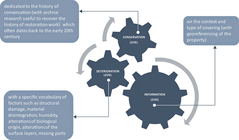
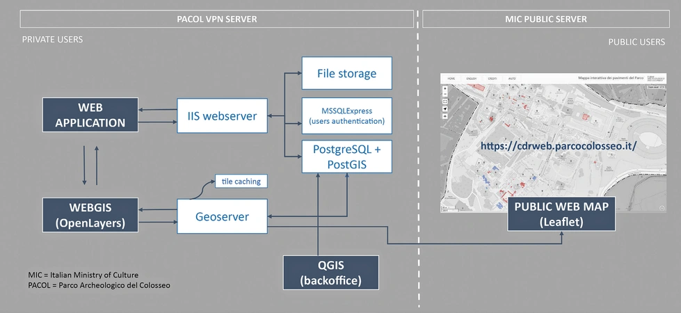
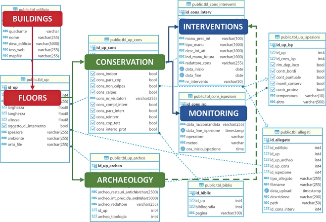
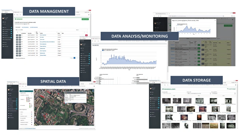
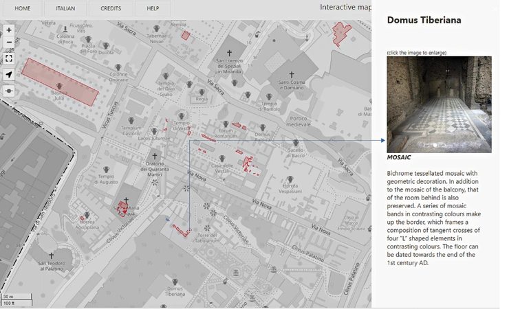
In 2018 the Parco Archeologico del Colosseo set out on a three-year basis project, the ‘Risk Map of Floors Surfaces’, with the aim of preserving and monitoring all the in situ floor coverings of the Roman Forum and the Palatine Hill areas (mosaics, sectile, cement floors, spicata). In order to systematically address this methodological approach a team of archaeologists, architects and restorers designed and created a comprehensive and functional information management system, the ‘Risk Map of the Mosaic and Marble Surfaces’, together with a web-based application with integrated webGIS tools. The platform is used daily to record historical-archaeological and archival data and it has become an essential tool in planning interventions in the field. This approach brings the Parco to move from emergency maintenance to a continuous cycle of systematic maintenance. At the end of the first three-year phase of the project, an interactive web map was published online in May 2022 to share selected data related to the ancient floors of the Parco with public users. At this stage, the web map (https://cdrweb.parcocolosseo.it) allows to obtain descriptive texts and a gallery of images of the ancient floors; there are plans in the next future to improve data sharing through API and web map services.
Figures
Preview
Subjects:
GIS and cartography Cultural Resource Management
Download (PDF)Supplementary resources:
Publishers:
CNR - Istituto di Scienze del Patrimonio Culturale
Edizioni All'Insegna del Giglio
This website uses only technical cookies strictly necessary for its proper functioning. It doesn't perform any profiling and doesn't use third party cookies of any kind.
Read our privacy policy for additional information.
By clicking 'OK' or closing this banner you acknowledge having read this information and accept the website's contents.

